
|
The tidal forcing for HOPS in the Monterey Bay was estimated using
the OSU tidal inversion procedure (OTIS), with the
boundary conditions specified from the 1/2 degree resolution
Topex/Poseidon global tidal model (TPXO.5.1).
The information from three coastal tide gauge stations:
Santa Cruz, CA (lon=-122.0167, lat=36.9667);
Moss Landing, CA (lon=-121.79, lat=36.8017);
Monterey, Monterey Harbor, CA (lon=-121.8883, lat=36.605);
was assimilated to improve tidal estimated using the OTIS representer method.
Tidal inversion was performed in the spectral domain for all main tidal constituents in Monterey Bay. See the table at right for the constituents at Santa Cruz. |
|
||||||||||||||||||||||||||||||
| Tidal constituent estimates (h,u,v) were then utilized as the boundary tidal forcing for HOPS. Since the AOSN-II domain is of a regional scale, with mostly open boundaries, the tidal forcing occurs mostly through the open boundary conditions and the contribution of the astronomical tidal forcing inside the domain is negligible. | |||||||||||||||||||||||||||||||
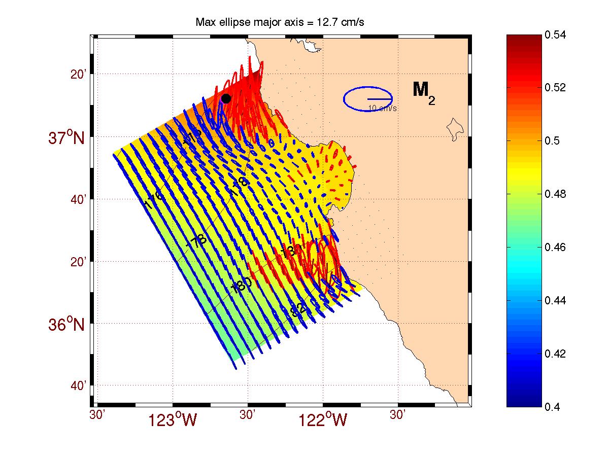
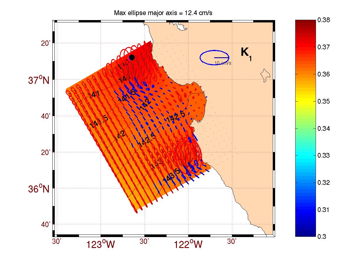
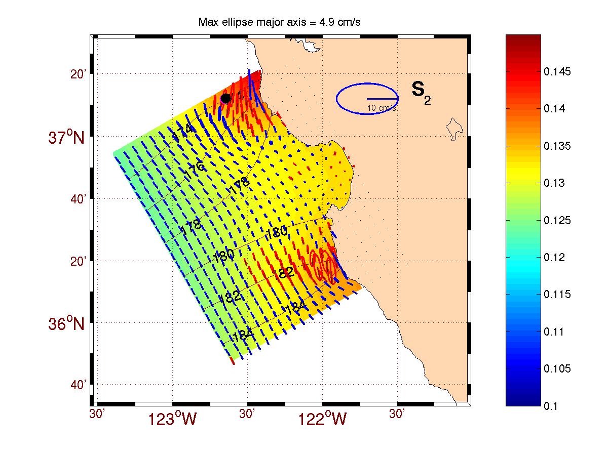
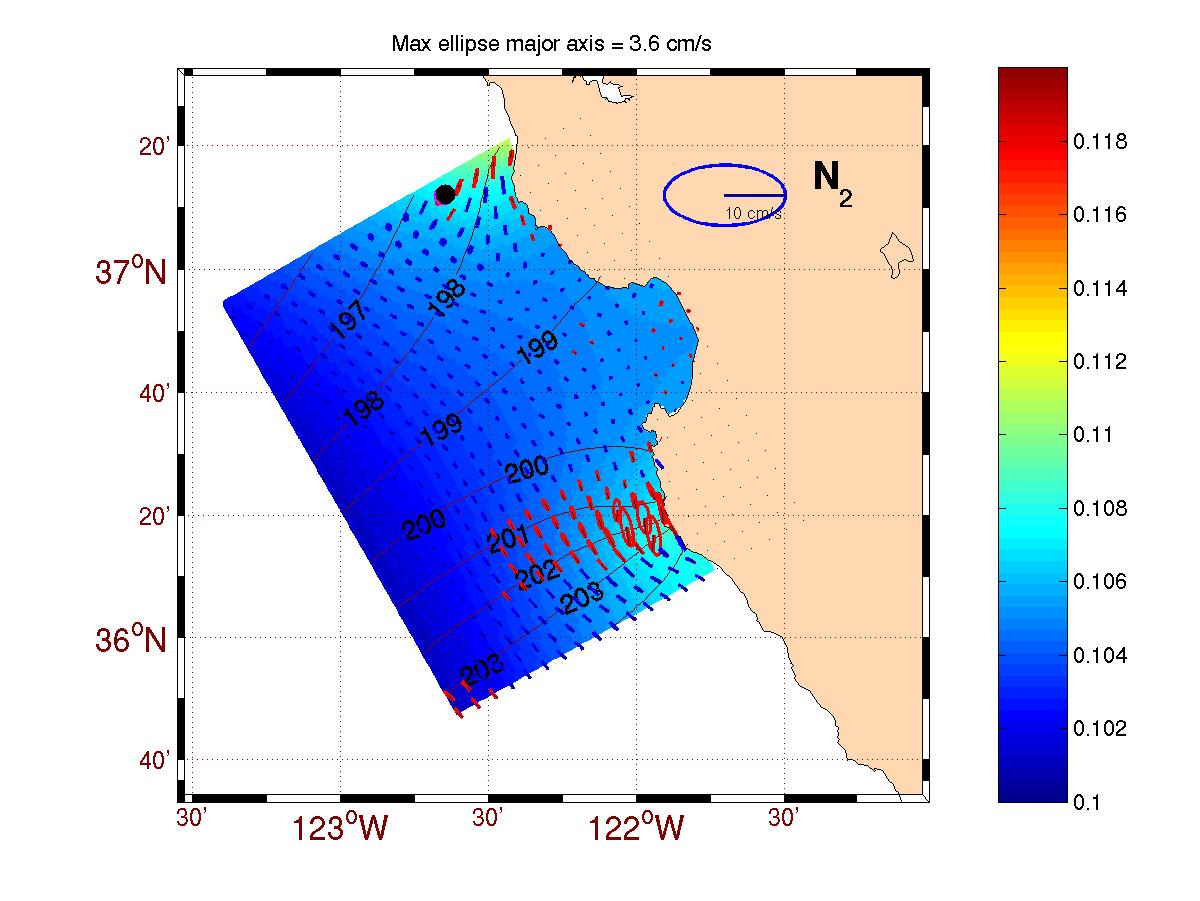
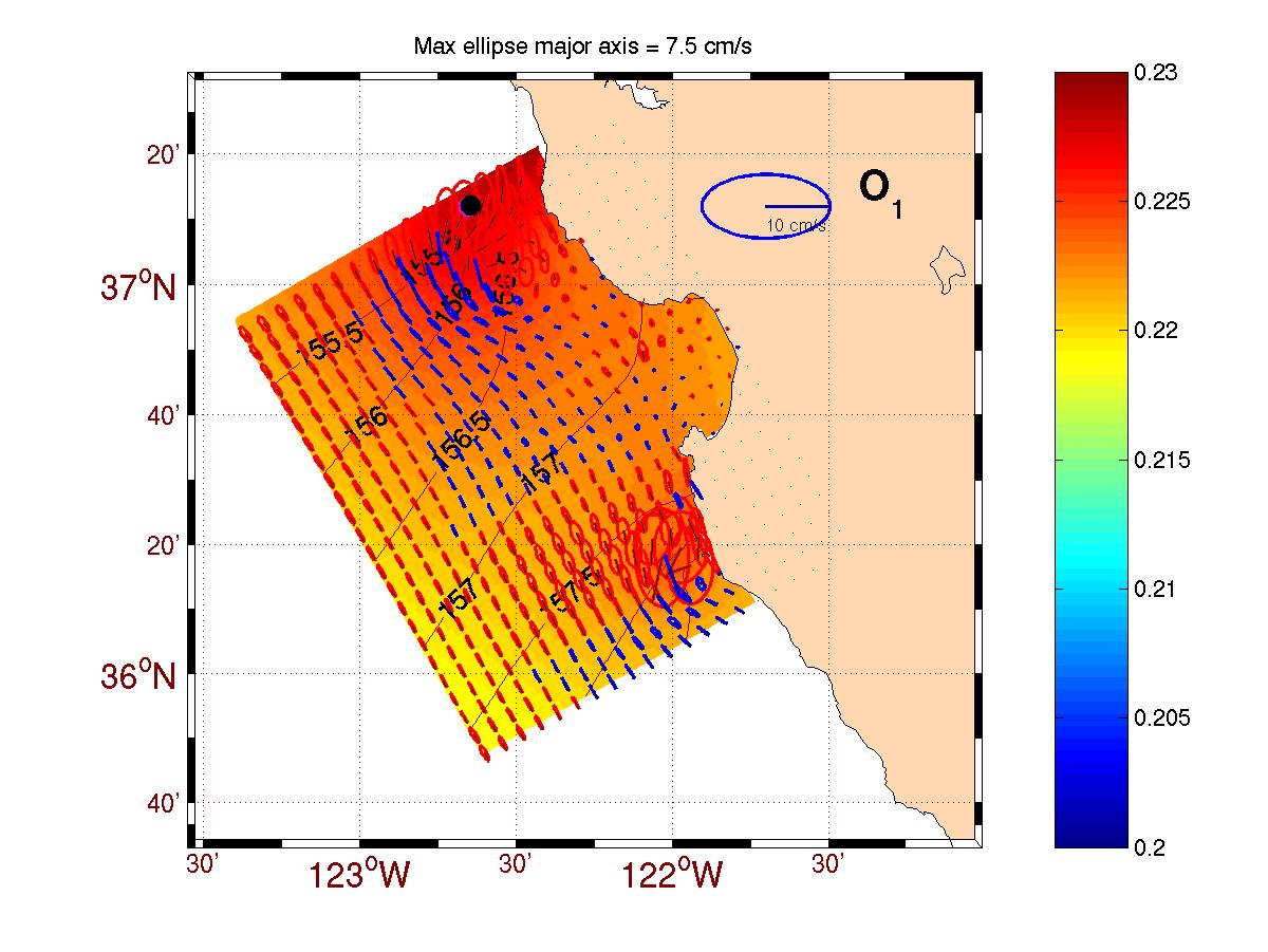
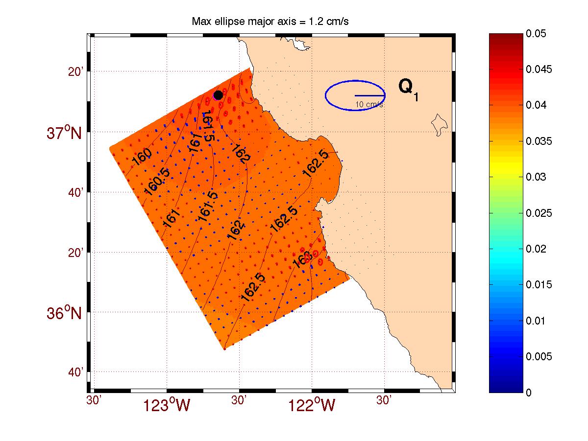
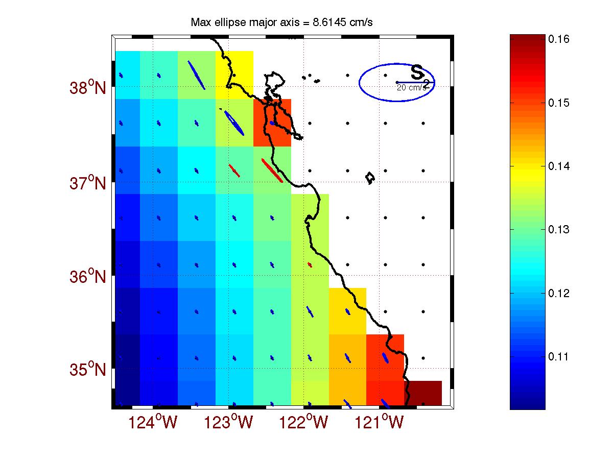
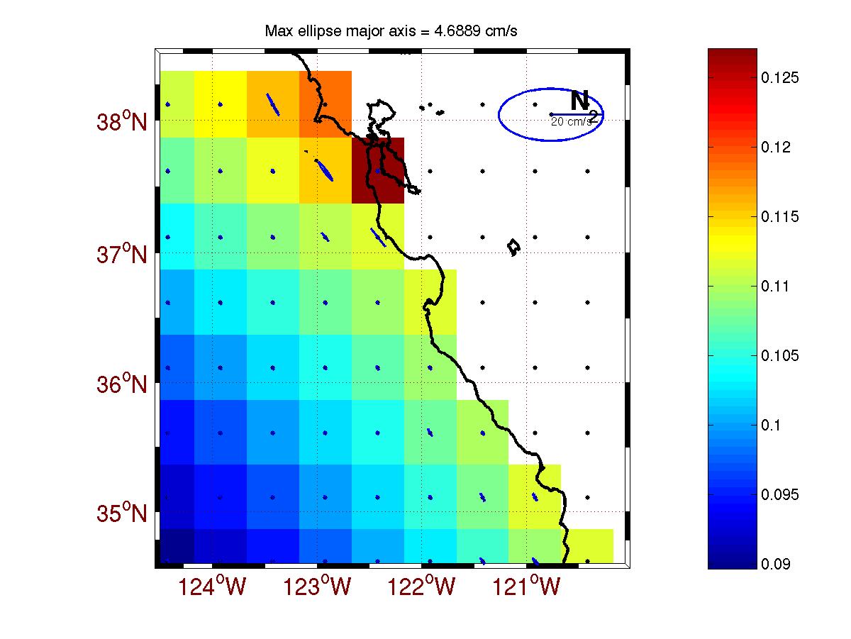
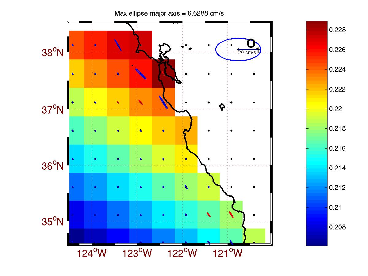
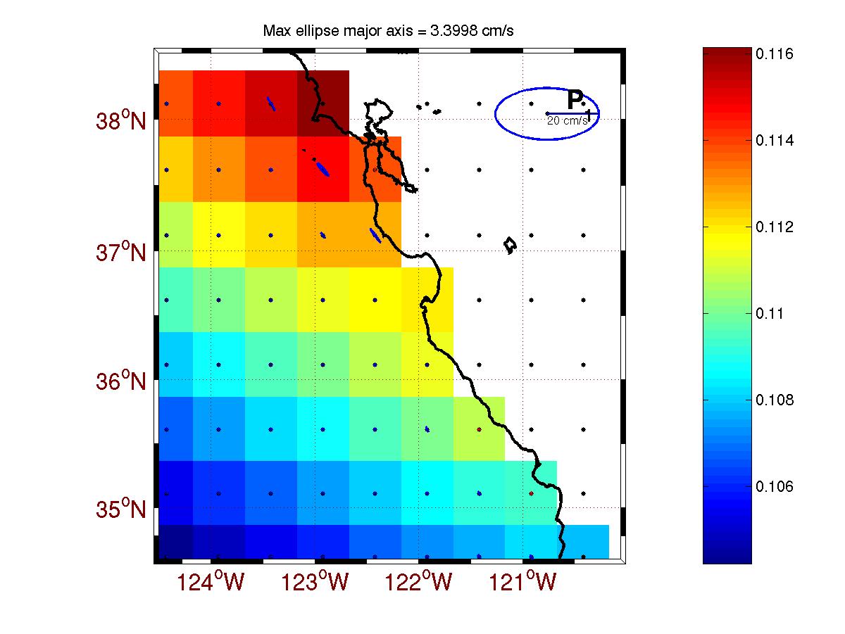
| The first seven figures below show the OTIS estimates of the tidal constituents (ssh,u,v) within the AOSN-II HOPS domain. These figures can be compared against the next set of seven figures which are the global tidal model TPXO.5.1 (1/2 degree resolution) constituent estimates . These global model estimates were used as forcing for OTIS. | |||||||||||||||||||||||||||||||
| OTIS Estimates | ||
|
|
|
|
| M2 | K1 | S2 |
|
|
|
|
| N2 | O1 | P1 |
|
|
||
| Q1 | ||
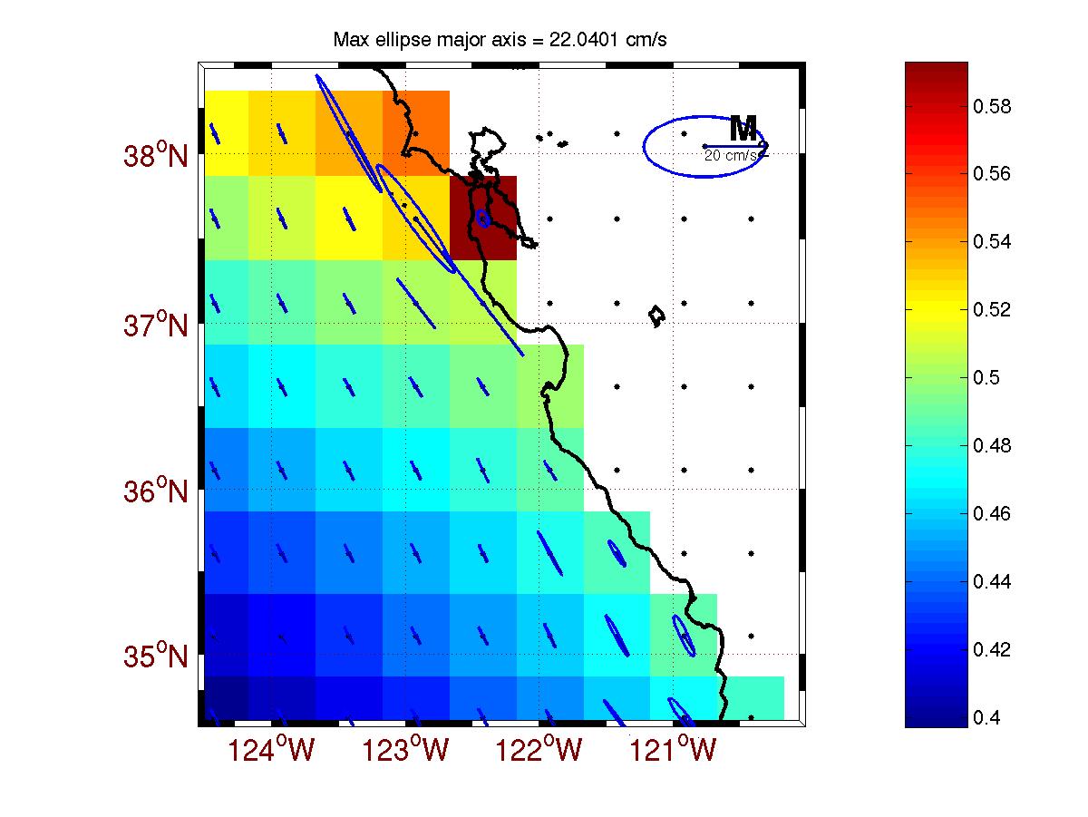
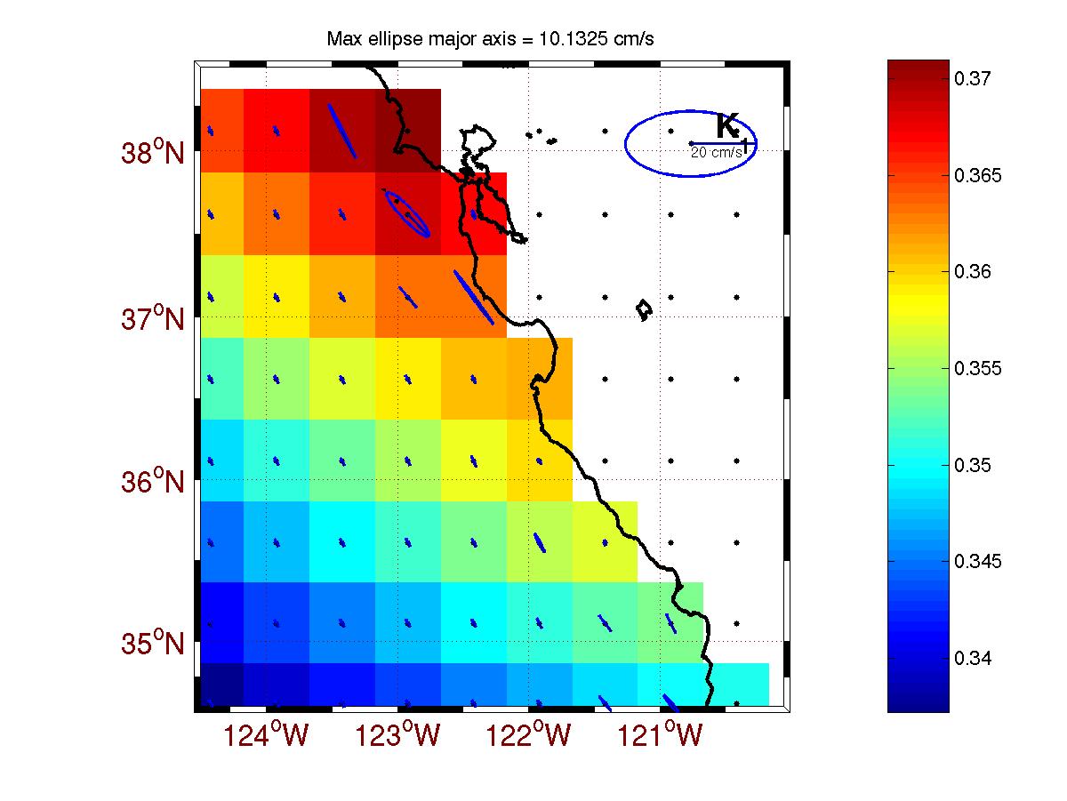
| TPX0.5.1 Estimates | ||
|
|
|
|
| M2 | K1 | S2 |
|
|
|
|
| N2 | O1 | P1 |
|
|
||
| Q1 | ||
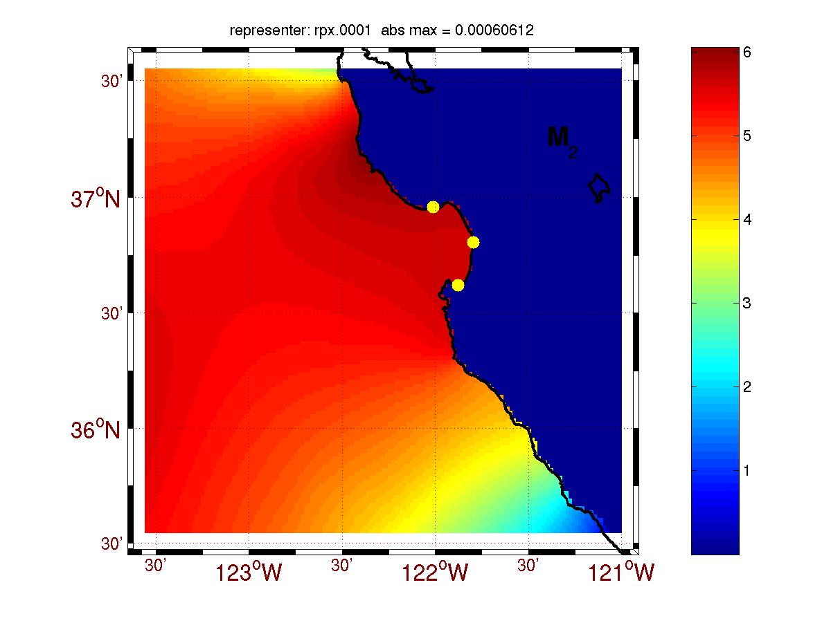
| The semi-diurnal constituent estimates are the inverse estimates with the tide gauge ssh assimilated via the representer method. An example of a representer for the M2 component is shown here. |
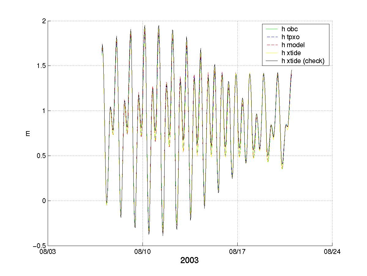
| Finally, the tidal signal time series for the AOSN-II period (Aug., 2003) is presented in this plot. |
| This time series corresponds to Santa Cruz,CA (lon=-122.0167 lat=36.9667) and features comparison of the observed and OTIS model tidal SSH estimates. |